Rivers of India: A Complete State-by-State Guide for Tourists and Research Students
9 mins read
India's rivers don't just carry water. They carry civilization, faith, and the future of 1.4 billion people. Ancient cities were born on their banks. Sacred texts were written in their praise. Farmers have depended on them for thousands of years. And today, millions of tourists travel across the country just to stand beside them, sail on them, or simply watch them flow.
But here is the truth that every tourist and every research student must know before they arrive: not all of India's rivers are in good health. Some are crystal clear and breathtakingly beautiful. Others are severely polluted and unsafe even for bathing. This guide tells you both stories honestly, state by state, river by river.
Whether you are planning a trip, writing a research paper, or simply curious about the water that built this country — this is the guide for you.
A Quick Note on River Health
Before we begin, here is how to understand the condition ratings used throughout this guide:
Clean means the river water is good quality and safe for drinking after standard treatment. It supports healthy fish and aquatic life and is suitable for irrigation.
Moderate means the river is usable for irrigation with monitoring, but drinking requires heavy treatment. Bathing in some stretches may be acceptable.
Warning means pollution levels are elevated. The river is not safe for drinking or bathing. Agricultural use requires caution.
Critical means the river is severely polluted and classified as a public health hazard. It is unfit for drinking, bathing, or direct agricultural use in most stretches.
Pristine means the river is in original condition, not yet highly populated.
According to the Central Pollution Control Board (CPCB), as of 2022–23, 296 river stretches across India fail to meet safe water quality criteria. Nearly 46% of India's monitored rivers are classified as polluted. Nearly 70% of India's surface water is unfit for direct consumption. Yet 500 million people depend on rivers for daily life. Keep this in mind as you read.
The Ganga (Ganges)
States: Uttarakhand, Uttar Pradesh, Bihar, Jharkhand, West Bengal
Length: 2,525 km | Origin: Gangotri Glacier, Uttarakhand | Flows into: Bay of Bengal
Current Health Status: Critical
There is no river in the world quite like the Ganga. It is the holiest river in Hinduism, the longest river in India, and the lifeblood of more than 500 million people who live along its banks. Cities like Varanasi, Prayagraj, Patna, and Haridwar were built beside it and have thrived for thousands of years because of it.
At Rishikesh and Haridwar in Uttarakhand, the Ganga is a roaring, glacier-fed torrent — cold, fast, and remarkably clean.
For tourists: Go to Rishikesh and Haridwar for the clean upper stretches. Do the Ganga Aarti at Varanasi for the spiritual experience. Take a dawn boat ride. But do not swim in the Ganga below Haridwar, and do not drink the water untreated under any circumstances.
Best time to visit: October to March for the upper stretches. Avoid monsoon months for water-contact activities.
The Yamuna
States: Uttarakhand, Himachal Pradesh, Haryana, Delhi, Uttar Pradesh
Length: 1,376 km | Origin: Yamunotri Glacier, Uttarakhand | Flows into: Ganga at Prayagraj
Current Health Status: Critical
The Yamuna begins its life as one of the most beautiful rivers in the Himalayas. At Yamunotri in Uttarakhand, its source is a sacred glacial spring at an altitude of over 3,000 metres. The pilgrim trek to Yamunotri is part of the famous Char Dham circuit. The water here is cold, pure, and breathtaking.
As the river descends through Himachal Pradesh and Haryana, it remains relatively clean. It is only when the Yamuna reaches Delhi that everything changes — and it changes catastrophically.
The Taj Mahal in Agra was built on its banks, and its reflection in the river is one of the iconic images of India. In Vrindavan and Mathura in Uttar Pradesh, the Yamuna is associated with the god Krishna and remains a pilgrimage destination for millions of Hindus. After it passes through the heavily polluted Delhi–Agra stretch, the river gradually begins to recover as it flows through UP toward its meeting with the Ganga at Prayagraj.
For tourists: Visit Yamunotri for the pristine glacier source. Visit Mathura and Vrindavan for the spiritual and cultural significance. Visit Agra for the Taj Mahal.
Best time to visit: September to November for the upper stretches. Avoid the Delhi stretch entirely for any water contact.
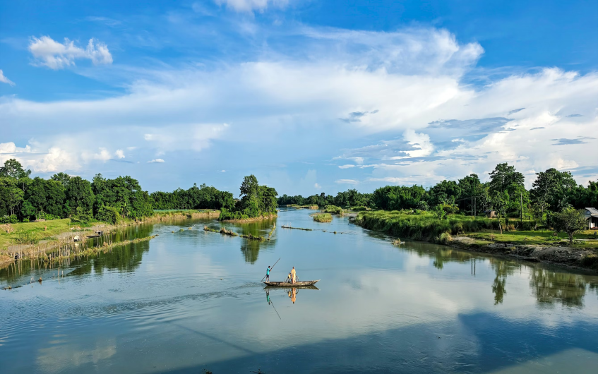
The Brahmaputra
States: Arunachal Pradesh, Assam
Length: 2,900 km total (918 km in India) | Origin: Tibetan Plateau (as Yarlung Tsangpo) | Flows into: Bay of Bengal (via Bangladesh)
Current Health Status: Warning (varies by stretch)
The Brahmaputra is one of the great rivers of the world. It begins its journey on the Tibetan Plateau as the Yarlung Tsangpo — flowing through one of the deepest river gorges on earth before punching through the eastern Himalayas into Arunachal Pradesh. In India, it transforms into a majestic, braided river that flows westward across Assam before turning south into Bangladesh.
The Brahmaputra is the lifeline of India's entire Northeast. It supports one of the world's richest river ecosystems, including the one-horned rhinoceros, the Gangetic river dolphin, and the Bengal tiger. Kaziranga National Park — which sits on its southern bank in Assam — is a UNESCO World Heritage Site and home to two-thirds of the world's remaining one-horned rhinos.
In Arunachal Pradesh, the Brahmaputra's water is largely pristine — clean glacial. As it enters Assam, however, the picture changes. Guwahati generates approximately 154 million litres of sewage daily, most of which is discharged untreated into the river.
For tourists: The MV Mahabaahu river cruise from Guwahati is one of India's finest travel experiences — a multi-night journey through Assam's waterways, wildlife sanctuaries, and river villages. Majuli Island deserves at least two nights. Kaziranga National Park is one of India's top wildlife destinations. River dolphin spotting near Tezpur is unforgettable.
Best time to visit: October to April for cruises and wildlife. Avoid June to September for tourist activities, though the monsoon-season river is spectacular if you are there for research or photography.
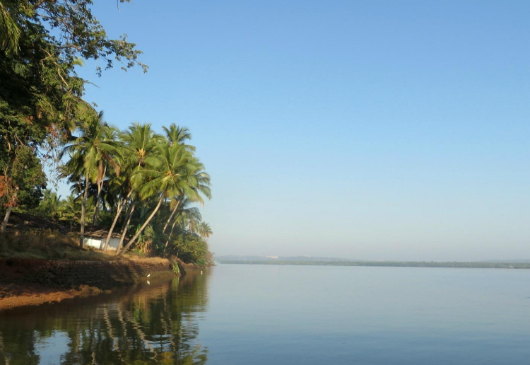
The Umngot (Dawki River)
State: Meghalaya
Length: ~60 km in India | Origin: Eastern Shillong Peak (1,800m) | Flows into: Bangladesh
Current Health Status: Clean — Cleanest River in Asia
If you have ever seen a photograph of boats that appear to be floating in mid-air, with no water visible beneath them — just a perfectly clear riverbed of smooth stones — you have seen the Umngot. It is not an illusion. The water of the Umngot River is genuinely that clear.
The Umngot flows through the Khasi and Jaintia Hills of Meghalaya and crosses the India-Bangladesh border near the town of Dawki. It is widely considered the cleanest river in Asia. The reason it has remained so clean is simple and remarkable: the communities that live on its banks — the Khasi and Jaintia people — have chosen to protect it.
There are strict no-plastic rules along the entire river. Industrial activity near the banks is banned. Tourism is actively managed to prevent overcrowding. The tribal village councils enforce these rules with genuine commitment, and the result is a river that looks like something from a dream.
For tourists: This is genuinely one of India's most spectacular natural experiences. Go in December or January for the lowest water level and the clearest views of the riverbed. Arrive at dawn before tourist boats multiply. The boat ride on the Umngot at Dawki costs between ₹800 and ₹1,200.
Best time to visit: October to April. Avoid June to September (monsoon makes the water murky).
The Narmada
States: Madhya Pradesh, Maharashtra, Gujarat
Length: 1,312 km | Origin: Amarkantak Plateau, Madhya Pradesh | Flows into: Gulf of Khambhat, Arabian Sea
Current Health Status: Moderate
The Narmada is one of the most sacred rivers in India — and one of the most debated. It is the only major peninsular river that flows westward rather than east, carving a spectacular rift valley through central India before emptying into the Arabian Sea in Gujarat. It has its own pilgrimage — the Narmada Parikrama — a walk of approximately 2,600 km along both banks that devout Hindus undertake over the course of months or even years.
The upper stretches of the Narmada in Madhya Pradesh remain relatively clean. River quality is good enough for the traditional rituals of the Narmada Parikrama pilgrims, and the water supports healthy fisheries in many sections. As the river enters Gujarat and approaches its industrial lower reaches, however, quality deteriorates.
The Sardar Sarovar Dam on the Gujarat-Madhya Pradesh border is operational now and provides significant irrigation and drinking water to Gujarat.
For tourists: Bhedaghat is the essential destination on this river. The moonlight boat ride through the marble gorge is extraordinary. Amarkantak — the source of the Narmada in the Vindhya hills — is a peaceful pilgrimage town worth visiting. Maheshwar on the banks in Madhya Pradesh is one of central India's most beautiful riverside towns, with a magnificent fort and a tradition of handloom weaving.
Best time to visit: October to March for Bhedaghat and the marble gorge. July to September for the Dhuandhar Falls in monsoon splendour.
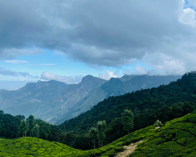
The Godavari
States: Maharashtra, Telangana, Andhra Pradesh, Chhattisgarh, Odisha
Length: 1,465 km (India's second longest river) | Origin: Trimbakeshwar, Nashik, Maharashtra | Flows into: Bay of Bengal
Current Health Status: Warning
The Godavari is peninsular India's mightiest river. It is sometimes called the Dakshin Ganga — the Ganges of the South — because of its spiritual significance and the vast territory it drains. It rises from a sacred spring at Trimbakeshwar near Nashik in Maharashtra, flows east across the Deccan plateau for nearly 1,500 kilometres, and empties into the Bay of Bengal through a wide, fertile delta in Andhra Pradesh.
The Godavari basin is larger than the United Kingdom. It supports enormous agricultural wealth — particularly rice farming in the Krishna-Godavari delta, which has been one of Asia's most productive agricultural regions for centuries. The river is sacred to millions of Hindus and hosts the Pushkaram festival every twelve years, which draws tens of millions of pilgrims to the river's banks.
At Rajahmundry, the Godavari opens into its delta and becomes broad, slow, and majestic. The mangroves near Kakinada support rich biodiversity. The Kolleru Lake, fed by the delta, is a major wetland for migratory birds.
Unfortunately, over 34 cities discharge sewage into the Godavari either untreated or partially treated.
For tourists: Papikondalu is the essential experience — book the overnight boat journey in October to February, ideally at least three weeks in advance as it sells out completely. Trimbakeshwar at the source is a major pilgrimage destination. The Rajahmundry riverfront and the Godavari delta are worth exploring.
Best time to visit: October to February for Papikondalu. Avoid monsoon months for river travel.
The Krishna
States: Maharashtra, Karnataka, Telangana, Andhra Pradesh
Length: 1,400 km | Origin: Mahabaleshwar, Maharashtra | Flows into: Bay of Bengal
Current Health Status: Moderate
The Krishna rises at the sacred hill station of Mahabaleshwar in the Western Ghats of Maharashtra and flows east across the Deccan plateau for 1,400 kilometres before reaching the Bay of Bengal. It is one of South India's most important rivers for agriculture, supporting intensive farming across four states through a network of canals and reservoirs.
The Nagarjuna Sagar Dam in Telangana — one of the world's largest masonry dams — creates a massive reservoir on the Krishna. The Srisailam Dam nearby is both an engineering marvel and a pilgrimage site, with an ancient Shiva temple on its banks.
Water sharing is a constant tension on the Krishna. The river is divided between Maharashtra, Karnataka, Telangana, and Andhra Pradesh through a complex legal arrangement that has been contested in courts and tribunals for decades. Disputes over water allocation intensify every time monsoon rains are below average.
For tourists: Hampi is unmissable — plan at least two full days among the ruins. Stay on the northern bank for a more peaceful experience. The monsoon months fill the river dramatically and the ruins look spectacular against the rain clouds, though some areas flood.
Best time to visit: October to February for Hampi.
The Kaveri (Cauvery)
States: Karnataka, Tamil Nadu, Kerala (headwaters), Puducherry (delta)
Length: 800 km | Origin: Talakaveri, Kodagu (Coorg), Karnataka | Flows into: Bay of Bengal
Current Health Status: Moderate
The Kaveri is South India's most famous river. It rises from a sacred spring at Talakaveri in the mist-covered coffee estates of Coorg in Karnataka, and flows east through Karnataka and Tamil Nadu before splitting into a broad, fertile delta and emptying into the Bay of Bengal. It is worshipped as a goddess across South India, and its fertile delta — the Rice Bowl of Tamil Nadu — has supported Tamil civilization for over two thousand years.
The great Chola temples at Thanjavur, Kumbakonam, and Chidambaram were built with the rice revenues of the Kaveri farmers.
The river's water quality is good in its upper reaches through Coorg and the Kodagu hills, where the land is forested and the population sparse. As it enters more densely populated and agricultural areas in Karnataka and Tamil Nadu, the quality declines.
The Cauvery water dispute between Karnataka and Tamil Nadu is one of the longest-running inter-state conflicts in Indian history. It has been in continuous legal dispute since 1892 — more than 130 years. Protests, shutdowns, and violent incidents occur whenever the water-sharing arrangement breaks down, which happens with some regularity during below-average monsoon years.
For tourists: Coorg (Kodagu) is one of Karnataka's most beautiful destinations — the Kaveri's source landscape of coffee estates, forest, and mist-covered hills is extraordinary. Shivanasamudra Falls is worth the detour from Mysuru. Ranganathittu at dawn in November to January is one of South India's finest wildlife experiences.
Best time to visit: October to March for Coorg and Ranganathittu. June to August for the Shivanasamudra Falls at their monsoon peak.
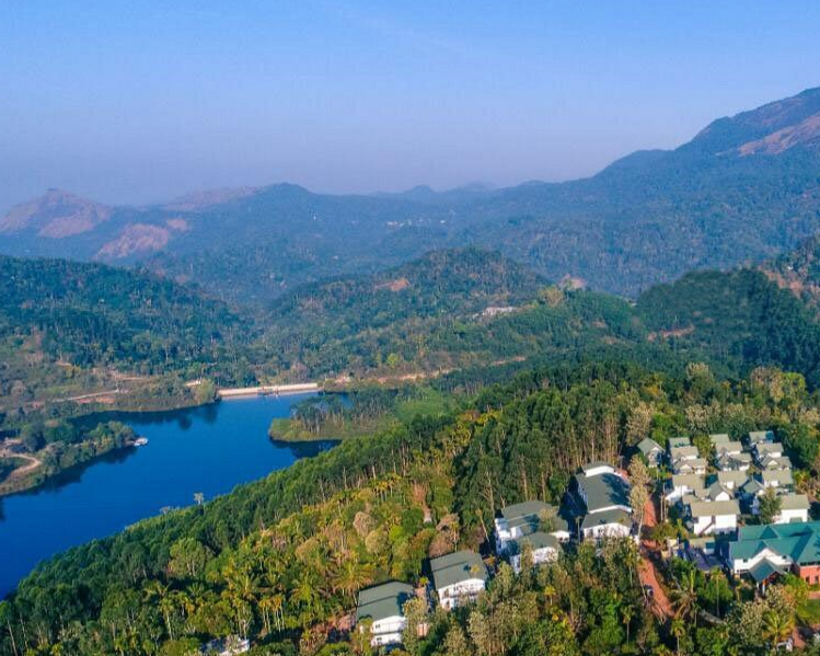
The Periyar
States: Kerala (main river), Tamil Nadu (headwaters)
Length: 244 km | Origin: Sivagiri Hills, Western Ghats | Flows into: Arabian Sea
Current Health Status: Clean
The Periyar is Kerala's longest river and one of its most important. Its upper reaches flow through the Periyar Tiger Reserve — a magnificent forest sanctuary in the Western Ghats — where the water is among the cleanest in India. The forest filters the water naturally, and the strict protections around the wildlife sanctuary have kept industrial and agricultural activity away from the upper catchment.
The Thekkady boat safari on the Periyar reservoir — created by the Mullaperiyar Dam — is one of the most atmospheric wildlife experiences in India. The boats drift through still waters surrounded by forest, and elephants frequently walk to the water's edge to drink.
The Periyar Tiger Reserve also offers bamboo rafting and guided forest treks — some of the best in Kerala.
The lower stretches of the Periyar, as it descends toward the Arabian Sea through Ernakulam district, face more urban pressure. But the upper river remains a genuine conservation success.
For tourists: Thekkady and the Periyar Tiger Reserve are essential Kerala destinations. Book the 7am dawn boat safari without exception — this is when elephants walk into the water and wildlife is most active. The 9am and 11am boats carry four times more tourists and see a fraction of the wildlife.
Best time to visit: October to March.
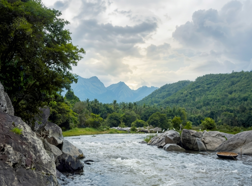
The Chambal
States: Madhya Pradesh, Rajasthan, Uttar Pradesh
Length: 960 km | Origin: Vindhya Range, Madhya Pradesh | Flows into: Yamuna River, Uttar Pradesh
Current Health Status: Clean
The Chambal is India's most improbable success story in river conservation — and most tourists have never heard of it. Today, the National Chambal Sanctuary — stretching across Madhya Pradesh, Rajasthan, and Uttar Pradesh — is one of India's most important freshwater conservation zones.
The water quality of the Chambal is genuinely good by Indian standards. No major city sits on its banks. Industrial development along its course is minimal. The presence of gharials — which are among the most sensitive indicators of freshwater quality — confirms that the river's ecosystem is largely healthy.
For tourists: Boat safaris from Dholpur in Rajasthan or the Morena district of Madhya Pradesh take you through extraordinary landscapes of cliffs, sandbanks, and pristine water where gharials bask in the sun and dolphins surface unexpectedly.
Best time to visit: October to March. Gharial nesting season in March and April is spectacular — hatchlings can be seen on the sandbanks.
The Sabarmati
States: Rajasthan, Gujarat
Length: 371 km | Origin: Aravalli Hills, Rajasthan | Flows into: Gulf of Khambhat, Arabian Sea
Current Health Status: Critical
Mahatma Gandhi's Sabarmati Ashram stood on its banks in Ahmedabad for over a decade. The Dandi March — one of the defining acts of India's independence movement — began here on March 12, 1930, when Gandhi and 78 followers walked 241 kilometres to the sea to make salt in defiance of British law.
Today, the Sabarmati Riverfront in Ahmedabad is a celebrated urban development project — a beautifully designed promenade of walkways, gardens, and public spaces along both banks of the river. Millions of people visit it every year. The Atal Pedestrian Bridge is a striking piece of architecture. The riverfront is genuinely pleasant to walk along in the evenings.
For tourists: The Sabarmati Ashram is one of India's most important and moving heritage sites and is entirely free to enter. The 6:30am morning prayer is particularly special. The riverfront promenade is pleasant for an evening walk. The Ahmedabad Heritage Walk, which begins near the river ghats, is one of India's finest urban heritage walks.
Best time to visit: November to February.
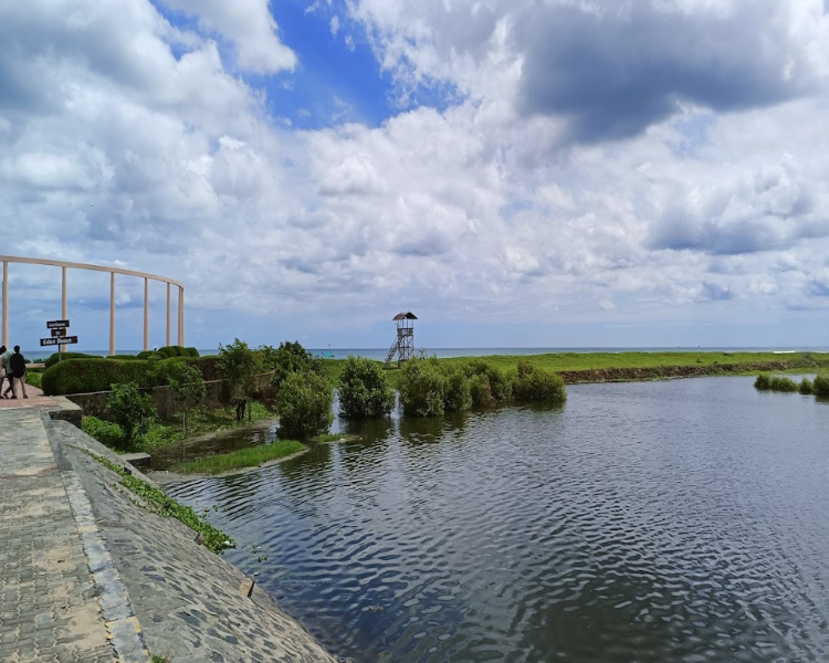
The Mahanadi
States: Chhattisgarh, Odisha
Length: 858 km | Origin: Sihawa, Chhattisgarh | Flows into: Bay of Bengal
Current Health Status: Moderate
The Mahanadi is the great river of Odisha. It drains a vast basin across Chhattisgarh and Odisha and supports the rice farming that feeds much of eastern India. Bhitarkanika, where the river meets the sea.
The Hirakud reservoir has become an important destination in its own right — a vast, serene body of water surrounded by hills, attracting enormous flocks of migratory birds in winter, including pelicans and flamingos. The river is also at the centre of a growing water dispute between Odisha and Chhattisgarh.
For tourists: Bhitarkanika and the Gahirmatha area in January and February, during the Olive Ridley mass nesting season, is one of the most remarkable wildlife events on earth. Permits are required from the Odisha Forest Department. Hirakud Reservoir is peaceful and beautiful in winter.
Best time to visit: November to February for wildlife and the turtle nesting season.
The Sutlej
States: Himachal Pradesh, Punjab, Rajasthan (via canal network)
Length: 1,450 km total (approximately 550 km in India) | Origin: Rakshastal Lake, Tibet | Flows into: Chenab River, Pakistan
Current Health Status: Warning (varies sharply by stretch)
Sutlej its upper reaches through Kinnaur district of Himachal Pradesh, it flows through some of the most spectacular mountain landscapes in the country — deep Himalayan gorges, ancient Buddhist monasteries perched on cliffs, and apple orchards clinging to terraced hillsides.
The water here is cold, clear glacial meltwater, rushing through one of Asia's most scenically extraordinary river valleys.
The Bhakra–Nangal dam system on the Sutlej in Punjab is one of India's great engineering achievements, creating the Gobind Sagar reservoir — among India's largest — and powering the irrigation that made Punjab the country's breadbasket during the Green Revolution. The Bhakra Dam itself is an icon of independent India's industrial ambition.
For tourists: The Kinnaur circuit in Himachal Pradesh — driving from Rampur through Kalpa to the high-altitude village of Chitkul along the Sutlej gorge — is one of India's most extraordinary road trips. Apple orchards, ancient monasteries, glaciers, and one of Asia's deepest river gorges. Go in September and October when the apples are being harvested.
Best time to visit: September to November for the Kinnaur circuit.
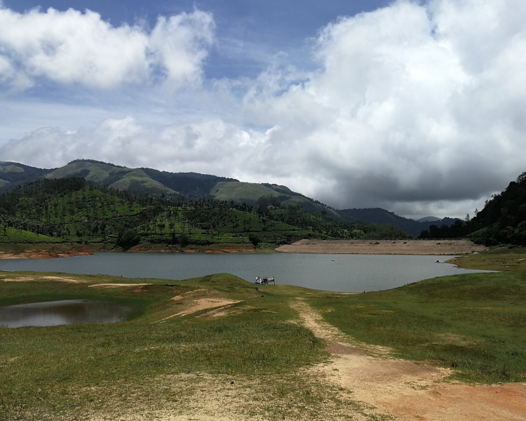
The Teesta
States: Sikkim, West Bengal
Length: 309 km | Origin: Pahunri Peak, North Sikkim | Flows into: Bangladesh (joins the Brahmaputra)
Current Health Status: Clean
The Teesta is one of India's most beautiful and dramatic rivers. It tumbles out of the Sikkim Himalayas in a series of white-water rapids that have made it one of Asia's premier destinations for river rafting. Crystal-clear glacial water rushes through deep gorges with the snow-covered peaks of Kanchenjunga — the world's third-highest mountain — visible above. It is a river of extraordinary visual power.
Sikkim is India's first fully organic state — all farming in the state is done without chemical pesticides or fertilizers, and this has helped protect the Teesta's upper basin from agricultural pollution. The water quality in Sikkim is excellent. The river supports rich freshwater biodiversity and is one of the cleanest major rivers in the country.
For tourists: Rafting on the Teesta in the Rangpo–Makha stretch in Sikkim is one of India's best adventure experiences
Best time to visit: March to May and October to November for rafting.
The Zanskar
State: Ladakh (Union Territory)
Length: ~105 km | Origin: Pensi La Pass, Ladakh | Flows into: Indus River near Nimmu
Current Health Status: Pristine
The Zanskar is India's most extreme river. In summer, it flows through a series of deep, turquoise-coloured gorges cut through the barren lunar landscape of Ladakh — some of the most dramatic canyon scenery in Asia. In winter, those same gorges freeze solid, and the frozen surface of the river becomes a road.
The Chadar Trek — named after the sheet of ice that covers the Zanskar in January and February — is one of the world's most extraordinary and demanding adventure journeys
For tourists: The Chadar Trek in January and February requires extreme physical fitness, mental resilience, proper permits
Best time to visit: Chadar Trek: January to February. Gorge rafting and trekking: June to September.
Conclusion: Why Rivers Matter
The rivers of India are not simply geographic features. They are the original infrastructure of one of the world's oldest civilisations. Cities like Varanasi, Patna, Agra, Nashik, Madurai, and Thanjavur exist because of the rivers beside them. Temples were built to honour these rivers.
Languages and literatures grew in their floodplains. Millions of farmers have fed their families from the water these rivers carry.
Today, these rivers face the most serious threats of their existence — not from floods or droughts, which they have always weathered, but from the slow accumulation of human neglect. Untreated sewage. Industrial effluents. Plastic waste. Excessive extraction. Climate change accelerating glacier loss in the Himalayas.
Check Similar blogs...
© 2025 All rights reserved. Pre Travel Booking.Com
Disclaimer: We may earn a commission from affiliate links on this page. These commissions help support our website at no extra cost to you. Rest assured, we only recommend products and services we genuinely believe in.
Designed and Developed by Apscode.com